Sidia is a education Platform website.


Thematic Cartography | 2024T
Able to draw the relief of the earth‘s surface properly and correctly using hachuring, plastic shading, contouring, morphography, and Tanaka Kitiro methods through independent assignments,
Remote Sensing Basic | 2024A
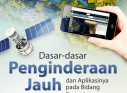
The Basic Remote Sensing course discusses the concept of remote sensing, the process of recognizing objects from images, the use of remote sensing for various
Remote Sensing Basic | 2024B
The Basic Remote Sensing course discusses the concept of remote sensing, the process of recognizing objects from images, the use of remote sensing for various
Remote Sensing Basic | 2024D
The Basic Remote Sensing course discusses the concept of remote sensing, the process of recognizing objects from images, the use of remote sensing for various
Remote Sensing Basic | 2024C
The Basic Remote Sensing course discusses the concept of remote sensing, the process of recognizing objects from images, the use of remote sensing for various
Remote Sensing Basic | 2024I
The Basic Remote Sensing course discusses the concept of remote sensing, the process of recognizing objects from images, the use of remote sensing for various
Copyright © 2026 Sinau Digital UNESA All Rights Reserved